
Land Use
Introduction
The Land Use Element is composed of the Future Land Use Maps, the land use categories designated within those maps, and the various concepts described in the following text that are intended to guide future growth, redevelopment, and other changes to the land use make-up of the county.
Future Land Use Maps
The Future Land Use Maps guide all changes to the zoning map. Each map defines land use categories as opposed to zoning districts. Land use categories are broadly defined as opposed to zoning districts which specifically detail lot size regulations, structure location requirements, and which uses are allowed, not allowed, or conditional. For example, there is one Forest and Agriculture land use category, but there are multiple Forest Agricultural Management (FAM) districts – FAM 1, FAM 2, and FAM 3 – each defined by a different minimum lot size requirement.
Some land use categories provide a clear indication of the intended future land use. For example, the activities that might occur in Forest and Agriculture (FA), Industrial (I), and Commercial Crossroads (CC) areas are easy to visualize.
In many instances, land use categories simply indicate general locations that can support future growth and development. For example, the Community Growth (CG) category and the Lakeshore Development Areas (LDA) were developed to guide development/redevelopment to appropriate areas; generally, this means areas where development has already occurred or areas which can reasonably be expected to support additional growth or redevelopment. Those categories may accommodate several uses and several differed zoning districts.
Land Use Categories
 Forest and Agriculture (FA)
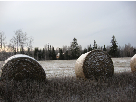 Areas intended primarily for forest and/or agriculture uses are shown as clear on the future land use map. This land use category primarily consists of forest harvest management and the raising of crops or livestock, as well as farm dwellings. In some cases, they consist of natural areas that are not being farmed or actively managed. Areas designated as Forest and Agriculture on the future land use map include areas not intended for future rural or urban development. The Forest and Agriculture land use category takes up the majority of the county’s unincorporated land area. Lot sizes are typically larger than 40 acres.
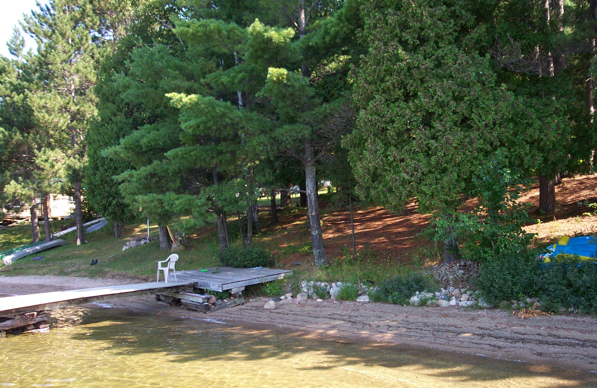
 Lakeshore Development Areas (LDA)
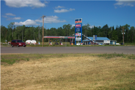
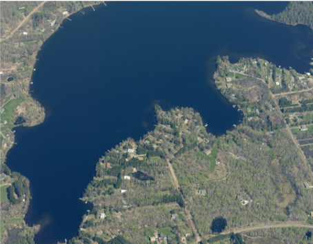 Lakeshore Development Areas are shown as orange on the Future Land Use Maps. These areas are intended for rural development adjacent to lakes, including infill, new development, or redevelopment of existing residential, commercial, or mixed-use areas. This category recognizes the ability of existing recreational or tourist facilities to grow and for new complimentary uses to be developed. These areas are important to the ability to live and work in rural portions of the county, given the economic goal to promote tourist services to supplement existing county economic drivers and for the county to attract outside investment. The scale and intensity of Lakeshore Development Areas are to be distinguished from uses requiring approval as planned resorts. This category may include uses of the size, scale, and intensity consistent with the county’s developed lakeshore areas, primarily characterized by uses such as:
- Single family residential
- Convenience grocery and fuel service
- Roadside restaurant
- Small-scale tourist service specialty shops such as fishing, hunting, snowmobiling, ATV, etc.
- Bed and breakfast facilities
- Motels/hotels
- Campgrounds
- Lakeshore related tourist service
Instrumental to Lakeshore Development Areas is the flexibility necessary to allow for the evolving and eclectic nature of the rural economy. This includes allowances for home occupations and isolated small businesses that are essential to the ability to live and work in rural areas.
 Rural Communities (RC)
 Rural Communities are shown as magenta on the Future Land Use Maps. The Rural Communities category includes existing unincorporated residential clusters of development, existing platted areas where some lots have been developed, or older unincorporated communities without community water and sewer systems. These areas are not focused along a lakeshore, as is the case with Lakeshore Development Areas.
Primary uses within this designation include the following:
- Single family residential
- Convenience grocery and fuel service
- Roadside restaurant
- Small-scale tourist service specialty shops such as fishing, hunting, snowmobiling, ATV, etc.
- Motels/hotels
- Local community facilities (schools, parks, etc.)
This designation allows an alternative to lakeshore living that may be a more affordable option for individuals and families.
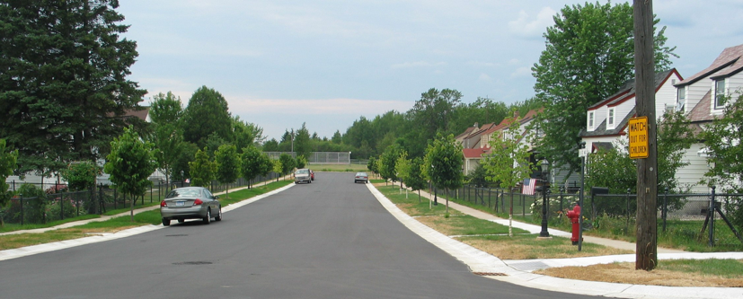
 Community Growth Areas (CG)
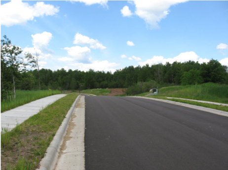 Community Growth Areas are shown as yellow on the Future Land Use Maps. Areas of Community Growth provide a preferred area for the expansion of communities that have a reasonable potential to grow in the next 20 years and beyond. This growth is strongly encouraged to be sewered when adjacent community development is already sewered. This land use category is intended for both incorporated and unincorporated communities. The intent of this land use category is to help communities guide future growth that would be most advantageous given environmental constraints, and various development opportunities (such as road access or proximity to existing development). Development within Community Growth areas is to be determined by local or county zoning, depending on the responsible jurisdiction. When Community Growth areas are developed on the fringe of an incorporated city, it is expected that the area will be annexed by that city.
 Crossroads Commercial (CC)
 Areas that are appropriate for Crossroad Commercial are shown as red on the Future Land Use Maps. The Crossroads Commercial land use category is intended to serve the commercial needs of local residents and the traveling public. The major goal for this category is to direct new commercial development to existing commercial nodes and currently undeveloped areas with adequate highway access. Typical uses include retail sales, restaurants, service stations, personal storage, and customer service-related uses. For example, the intersection of US Highway 53 and County Road 16 is a node designated Crossroads Commercial that includes existing commercial development that could be augmented in adjacent areas to take advantage of the higher-volume intersection.
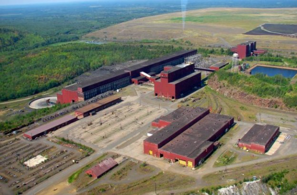
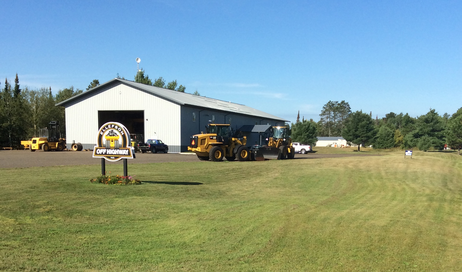
 Industrial (I)
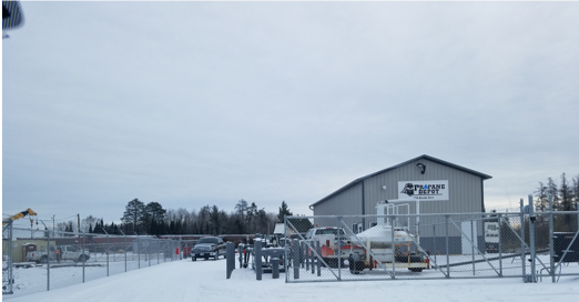 Industrial is shown as purple on the Future Land Use Maps. This designation consists of actively mined lands, ancillary operations to mining (such as actively used slag piles), and industrial businesses that may or may not support mining operations. This designation prohibits less intense uses such as retail sales and service, restaurants, and so forth that would be incompatible in an environment with heavy industrial land uses. Limited office use may be acceptable (for example, corporate offices in conjunction with a mining or trucking operation).
 Natural Areas (NA)
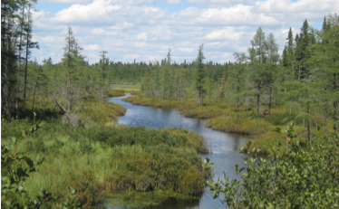 Natural Areas are shown as green on the Future Land Use Maps. This land use category is intended to protect areas of St. Louis County that are unsuitable for intensive development due to existing environmental constraints, such as flood-prone areas, areas under conservation easement, significant wildlife habitat areas, or other features likely to be harmful to the community if development is not properly managed in these areas. Outdoor recreational activities and limited agricultural use are expected within this land use category.
Intergovernmental Coordination
Townships
Prior to the adoption of the County Comprehensive Land Use Plan, many townships subject to county zoning relied upon land use plans that, collectively, served as the county’s plan. While some townships have more recently updated land use plans, many of these township plans were created in the 1970s or 1980s and were never updated.
Incorporation of Local Desires in the Plan
The intent of the county-wide County Comprehensive Land Use Plan is to reflect the desires of each township in the following ways:
- Use of Common Themes: All township plan policy language was reviewed to identify common themes. These common themes have been brought forward into the Land Use Goals, Objectives, & Implementation section.
- Zoning Overlay Districts: Several township land use plans included a finer level of detail than what is appropriate for county-wide planning. For townships who might desire this finer level of detail, a follow-up to the County Comprehensive Land Use Plan can be the creation of zoning overlay districts. These area-specific districts provide special guidance for land uses in townships that may desire such an approach.
- Continued Use of Land Use Plans: For townships who desire to continue to refer to their land use plan, they may continue to use it as a guidance document in the review of planning and zoning proposals (in addition to guidance provided in this Plan).
- Clarity Regarding County and Township Zoning Authority: Early in the Plan development process, it became apparent from township input that the path for townships to administer their own zoning or relinquish such authority to the county was unclear. County policy is in place to assist townships with that decision.
County and Township Planning Coordination
As a result of the County Comprehensive Land Use Plan, townships will continue to maintain their integral role in the planning application review process. County staff will continue to request a recommendation from the local township board on all subdivision, rezoning, variance, and conditional use permit applications. Township board recommendations will be considered in each Board of Adjustment and Planning Commission staff report in addition to ordinance and County Comprehensive Land Use Plan considerations.
Cities
Anticipating Expansion
Current (as of 2017) city land use planning documents and input relating to planned infrastructure extensions and opportunities for growth was collected and reviewed as part of the Plan development process. As a result, the Community Growth (CG) category of the Future Land Use Map has been applied in select areas at the edge of several cities in the county. In coordination with the county’s cities, the Future Land Use Map intends to anticipate areas of future service extensions and associated annexation. Cities anticipated to expand into unincorporated areas on the Future Land Use Map included Aurora, Babbitt, Biwabik, Chisholm, Cook, Ely, Floodwood, and Hermantown.
Community Development Funding
The county-city relationship is critical when it comes to community development-related grant funds. The county receives Community Development Block Grant (CDBG) funding from the U.S. Department of Housing and Urban Development (HUD) and distributes the funding to local communities and non-profit agencies through an annual competitive application process. The program focus areas include housing, community facilities and public infrastructure, economic development, and public services. The Land Use Goals, Objectives, & Implementation section supports the county’s continued critical involvement in leveraging CDBG funds to support revitalization and quality of life improvements in local cities. St. Louis County supports other community development initiatives through the County Housing and Redevelopment Authority, tax abatement, transportation sales tax, and other funding sources.
Tribes
The Fond du Lac Band of Lake Superior Chippewa and Bois Forte Band of Chippewa tribes are some of the original indigenous peoples of the area that is now St. Louis County and the Arrowhead region. Both tribal governments are recognized as sovereign nations.
Both the county and the tribes have a common interest to further the economic development of the county and each reservation. The county and the tribes also share many public infrastructure assets and services. The Land Use Goals, Objectives, & Implementation section encourages the county to further collaborate with the tribes. Collaboration could come in the form of shared county staff time to assist with, for example, GIS mapping/data sharing, tribal inclusion in economic development programs, or working together on road improvement projects.
Improving the Integrity of the Zoning Ordinance
The number of variances a jurisdiction handles on a consistent basis is a good measure of the integrity of that jurisdiction’s zoning regulations. Public input received in development of the County Comprehensive Land Use Plan noted a concern about the volume of variances that are regularly approved by the County Board of Adjustment. While some variances may be justified by a unique hardship imposed on the landowner, a hard look at the county’s variance process is needed to improve understanding of the process and adherence to existing criteria.
Through the Land Use Goals, Objectives, & Implementation section, various ways of improving the variance process and adherence to existing criteria are identified to ultimately reduce the volume of variance applications received by the county.
Economic Development and Future Land Use
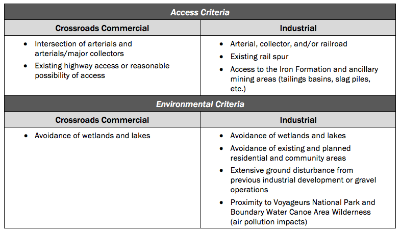
Commercial and industrial development is integral to economic development. The identification of areas with the appropriate characteristics for commercial and industrial development was a goal in the development of the Future Land Use Map. Table 6.1 summarizes the locational criteria that were used in the application of the Crossroads Commercial and Industrial categories on the Future Land Use Map:
Table 6.1 – Hierarchy of Roads
The county will look to capture highway-oriented commercial development through the Future Land Use Map Crossroads Commercial category and the supporting Goals, Objectives, & Implementation sections contained in this Plan. The aim of this strategy is to retain a greater amount of tourism-related dollars in the county and to re-energize existing intersections to cater to both a local and regional customer base.
Through the County Comprehensive Land Use Plan, the county looks to improve its positioning to take advantage of industrial development opportunities that arise in the future. These opportunities are wide ranging, from forestry-related industries such as milling, paper, construction, packaging, biofuels, and evolving mass timber applications, to mining-related industries such as heavy vehicle repair and manufacture and tailings reuse applications. The Future Land Use Map Industrial category has been applied in strategic locations to take advantage of future opportunities and support as provided through the Land Use Goals, Objectives, & Implementation section.
Supporting Unincorporated Communities
Historic rural communities and lakeshore subdivisions make up the fabric of unincorporated St. Louis County. These communities are often governed by a township board. The focus of much of the County Comprehensive Land Use Plan is toward the economic sustainability of these communities. While population, housing, and employment projections do not project significant growth in unincorporated communities, changes in the local, as well as national and global economic climate could have significant effects on specific portions of the county. For this reason, the Future Land Use Maps have targeted the following areas to capture potential future growth:
- Historic communities with major collector and arterial access. These include communities such as Embarrass, Cherry, and Cotton that are not located adjacent to a lake, but have the potential to accommodate more affordable housing options and have excellent highway access. The areas are identified on the Future Land Use Maps in the Rural Communities category.
- Lakeshore communities, consisting of collections of residential subdivisions focused on many of the county’s lakes, are where the majority of the county’s unincorporated population is located. These communities will continue to be popular places to both live year-round and to enjoy a second or seasonal home. Most property with good lakeshore access is developed. Areas yet to be developed are, for the most part, very difficult to access or are restricted by state or federal ownership.
Therefore, the Future Land Use Maps focus on supporting the development of “second tier” residential subdivisions that are not developed directly along a lakeshore, but enjoy access that is within a reasonable rural emergency response time (National Fire Protection Association standard of 6 to 14 minutes) and/or allows easy access to a nearby public access point. The development (and redevelopment) of additional commercial services is also encouraged in these areas, where compatible with existing development, to promote the ability to live in these communities on a year-round basis. The Lakeshore Development Area category identifies these areas of supportive development in existing lakeshore communities.
Paper Subdivisions
Many situations exist throughout the county where a platted subdivision exists only on paper – where the subdivision in its entirety was approved and recorded, but never constructed. Where development of at least a portion of these subdivisions may be feasible, the county encourages the improvement and development of such areas. However, in many situations, these “paper subdivisions” were platted in the early part of the 20th Century (or late 19th Century) prior to the advent of subdivision regulations. As a result, many paper subdivisions include unbuildable lots due to significant environmental constraints, such as wetlands and topography, and/or right-of-way that cannot be constructed due to similar constraints.
Where development is unreasonable due to the challenges noted above, the county will work to facilitate the merging or reversion to such acreage to a more productive use. For example, where a half-acre lot paper subdivision is in the Forest and Agriculture category on the future land use map, the reversion of the acreage to larger lots amenable to forest or agricultural use is preferred. With this approach, areas under the same ownership could be targeted initially. For areas with many lots under diverse ownership, a more feasible strategy could be to allow property taxes to default on such lots and legally revert to county ownership over time. Then the county could market the resulting property back to forestry, agricultural, or similar interests after the paper subdivision has been merged. A similar approach could be taken for paper subdivisions in the Natural Areas category of the Future Land Use Maps.
Tax-Forfeited Lands
What is Tax-Forfeited Land?
Tax-forfeited property is land that has forfeited to the State of Minnesota for the non-payment of property taxes. St. Louis County manages these lands in trust for the state. One of the goals of the County Comprehensive Land Use Plan is to leverage the economic potential of tax-forfeited land.
There are nearly 900,000 acres of tax-forfeited land in St. Louis County. This includes some properties within incorporated municipalities, but most of the land is contained in the unincorporated county. Roughly two-thirds of this property is considered as commercial forestland. Most lands are classified to be retained for forest and land management, but there are still substantial acreages which are not conductive for this purpose. These properties are classified for disposal through sale, conveyance, or exchange. The primary method of disposal is to sell the properties at public auction.
Apart from properties which are classified for long-term forest management or conservation, the county has a substantial interest in returning tax-forfeited properties to its tax rolls.
Property Classification
Counties are charged with managing tax-forfeited properties. They are responsible for prioritizing areas for development versus conservation. Minnesota Statute 282.01 grants each county board of commissioners the authority to classify tax-forfeited land as conservation versus non-conversation and describes the process for conveying these properties to public or private entities, as appropriate.
In St. Louis County, the Land and Minerals Department is responsible for preparing a list of land for potential sale and submitting properties for County Board approval. Land and Minerals along with the Planning and Community Development Department perform a scoping function, reviewing tax-forfeited properties for potential development opportunities, and making a recommended classification to the County Board. Note that the Minnesota Department of Natural Resources must approve parcels with sensitive natural features or parcels with potential for mineral extraction.
Strategy for Managing Tax-Forfeited Land
Many tax-forfeited properties are intended for long-term forest management and timber harvesting. Other properties may have potential for development. Some properties are located within municipalities or small towns, others within rural townships. Some properties have been platted or previously developed. Some may provide several valuable ecosystem services and should be conserved.
Some key considerations for managing tax-forfeited properties that are not intended for forest management are described below.
- Develop a better understanding of the inventory of tax-forfeited lands. Where are these properties located, and what are the general opportunities and constraints in each area? Which properties have been developed or are part of a paper subdivision? Which properties cannot be developed due to wetlands or other constraints? County GIS staff within the Planning and Community Development Department and Land and Minerals can help answer these questions and develop a more holistic approach to managing tax-forfeited lands.
- Continue to improve coordination with cities and townships. Underutilized properties can provide opportunities for public use, community development, affordable housing, and other needs that may already be identified by the community. Before these properties are sold at auction, the county should consult with the city or township to determine the best use for the land.
- Manage properties collectively when appropriate. When there is a large collection of tax-forfeited parcels in one area, there may be opportunities to implement a large project or a group of projects. For example, if the site contains or abuts extended, vacated right-of-way – especially railroad right-of-way – the area may have potential for a future regional trail connection (i.e., Rails to Trails). If this is the case, the county should coordinate with regional trail organizations, the Regional Railroad Authority, and other groups to understand the interest/need to hold property for a future trail.
- The county should continue to improve the process for marketing properties which are not actively managed for forestry purposes. Not all properties can be relinquished for development. Before properties are auctioned individually, the county should evaluate the potential for conservation. Large areas of wetlands and other areas which provide a substantial number of valuable ecosystem services should be conserved to the greatest extent possible. (See the Natural Environment element.) The county may also wish to retain some natural areas to expand the regional trail system or other uses that are compatible with outdoor recreation and tourism.
Other public lands that are managed for conservation or development include county fee lands, local government lands, state lands, and federal lands. The county will continue to coordinate with the appropriate entities as necessary (e.g. state and federal agencies, cities) to ensure that uses adjacent to lands not under county ownership are compatible to the greatest extent possible.
Cultural and Historic Resources
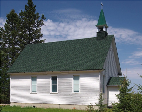
Cultural and historic resources connect us to the past and contribute significantly to community identity. From Native American sites to traditional urban architecture, preserving these resources is a key goal of long-range planning. “Historic preservation” means retaining, as much as possible, the key elements or “historic fabric” of important places that connect us to the past, through conservation, rehabilitation, and other means.
A common way to preserve cultural and historic sites is to have them formally recognized by the National Register of Historic Places. Historic places in the Register consist of sites, landmarks (structures), districts, and objects that have local, state, or national significance. In the unincorporated county, historic places often consist of early-settlement structures – churches, schools, or agricultural structures – and Native American cultural resources.
St. Louis County will work to protect cultural and historic resources by:
- Using subdivision design as a preservation tool. Like sensitive natural features, historic features that are worthy of conservation can be avoided through planning and design. For example, conservation subdivision design can be used to protect historic sites just as well as natural features. Known historic/cultural sites and sites with potential for historic designation should be identified during the zoning or subdivision proposals which might impact them. It may be wise to limit the extension of services or infrastructure in some areas altogether.
- Cataloging potential sites for inclusion on the National Register of Historic Places. St. Louis County can work with local historic chapters, providing technical expertise to help communities apply to the National Register.
- Coordinating with Tribes and the 1854 Treaty Authority to avoid cultural sites and gain a better understanding of areas which have tribal significance. Not all cultural aspects are inventoried. For example, in Native American cultures, many species of plants and animals retain great cultural significance. Through outreach and coordination with the Bois Forte and Fond Du Lac tribes, the county can help promote and preserve key aspects of tribal heritage.
- Ensure that cultural impacts are appropriately weighted in the environmental review process. Cultural and historic impacts must be analyzed as part of environmental documentation and review for federal projects (NEPA process). Cultural impacts should be weighted appropriately when comparing various design alternatives. Since NEPA projects involve federal funds, environmental review is typically performed by MnDOT or a private consultant that is contracted with MnDOT. St. Louis County residents and their elected and appointed officials participate through the public review process.
- Support the mission of the St. Louis County Historical Society. The Historical Society works to protect and preserve objects of cultural and historical research. The society has six affiliate organizations and operates a museum in Duluth. The county can support outreach efforts and help the society expand its archives, collections, and operations through continued funding.
Goal LU-1: The County Comprehensive Land Use Plan supports a flexible regulatory framework that serves local and countywide interests.
Objectives
LU-1.1: County zoning districts will be amended, removed, and/or created to establish consistency with the Future Land Use Map.
LU-1.2: Allow for the use of zoning overlay districts tailored to local township and development needs.
Goal LU-2: Continue to improve the usability, clarity, and adherence to all planning-related regulations.
Objectives
LU-2.1: Clearly communicate planning application requirements and procedures to landowners and developers.
LU-2.2: Work to improve the usability and clarity of planning-related regulatory documents.
Goal LU-3: Improve the integrity of the county’s planning-related regulations by minimizing and improving management of nonconformities.
Objectives
LU-3.1: Base variance decisions on uniform approval criterion to ensure all applicants are treated equitably, that community health and safety is protected, and that the overall character of a given area is preserved.
LU-3.2: County staff and decision-makers will work together to decrease the amount of zoning and subdivision ordinance nonconformities throughout the county.
LU-3.3: Acknowledge why nonconformities are a concern and that variances should be for exceptional circumstances as noted in Minnesota Statute 394.22 Subd.10.
LU-3.4: Where regular application of zoning regulations is not reasonable or practical, provide equitable solutions to be applied to variance applications on a consistent basis.
Goal LU-4: Development shall proceed in an orderly, efficient, and fiscally responsible manner.
Objectives
LU-4.1: When possible, direct new development toward areas already supported with improved infrastructure, public facilities, and areas in reasonable proximity to basic services.
LU-4.2: When development opportunities do arise in isolated areas, ensure such development is self-supporting and is otherwise consistent with the County Comprehensive Land Use Plan.
LU-4.3: Encourage infill, redevelopment, or reuse of vacant commercial or industrial properties.
LU-4.4: New development is expected to support all needed infrastructure improvements to be connected to existing transportation systems and other available infrastructure.
LU-4.5: Direct the development of new commercial/general purpose extractive use/borrow pits to areas designated as Forest and Agriculture (FA) on the Future Land Use Map.
LU-4.6: Where possible, work to facilitate the merging or reversion to acreage of undeveloped substandard lots in “paper subdivisions” that are designated on the Future Land Use Map as Forest and Agriculture (FA).
LU-4.7: “Paper subdivisions” in areas designated for residential, commercial, or industrial development will be evaluated to understand challenges in improving such areas to allow for development.
Goal LU-5: County residential areas are accessible, affordable, and livable for a broad spectrum of age and income groups.
Objectives
LU-5.1: The supply, type, and price of new housing should accurately reflect the needs of the St. Louis County population.
LU-5.2: Where needed, promote inclusive communities with affordable housing options.
LU-5.3: Protect established residences from encroachment and the unintended impacts of incompatible uses.
LU-5.4: Encourage an equitable distribution of schools, health care services, grocers, and other resources that are necessary to sustain personal well-being and enhance the quality of county communities.
LU-5.5: Work with state and other regional government, nonprofit, and development groups to identify opportunities for independent living developments in all areas of the county, such as in or adjacent to lakeshore communities.
Goal LU-6: Follow best practices for rural wastewater management.
Objectives
LU-6.1: Direct residential development toward areas with soils which are suitable for septic installation as permitted in the subsurface sewage treatment systems (SSTS) ordinance. Ensure that development density is appropriate given the soil characteristics of each site.
LU-6.2: Coordinate with local units of government to maintain corridors for extension of community sewer facilities in fringe growth areas.
LU-6.3: Encourage the expansion of sanitary districts in populated areas where individual subsurface sewage treatment systems (SSTS) are failing or in areas not suitable for SSTS and the conversion to community sewer is reasonable.
LU-6.4: Continue to work with appropriate local and state agencies and other entities to ensure timely repair or replacement of failing individual sewer systems.
LU-6.5: Continue county internal cooperation and cooperation with sanitary districts in the planning of sewage treatment system sites in relation to development of property for residences and other structures, and during the subdivision process.
Goal LU-7: Provide sufficient opportunities for commercial development to serve local and regional markets throughout the county.
Objectives
LU-7.1: Encourage expansion of regional commercial opportunities in existing commercial corridors along collector or arterial routes and at nodes where infrastructure and traffic volumes can support economic growth.
LU-7.2: Develop opportunities for neighborhood commercial sites that are compatible in scale and operation with surrounding residential development.
Goal LU-8: Provide sufficient opportunities for industrial development within the county.
Objective
LU-8.1: Retain large-acre sites that are located adjacent to existing industry and/or freight corridors to enable facility expansion or attract compatible industries.
Goal LU-9: Balance open space conservation and environmental preservation with the county’s economic development needs.
Objectives
LU-9.1: Proposed ferrous and non-ferrous mining areas should be preserved for possible resource extraction.
LU-9.2: Carefully manage platting and development activity in close proximity to areas improved and dedicated to outdoor recreation.
Goal LU-10: Ensure that new development is located, designed, and built to avoid environmental and other hazards.
Objectives
LU-10.1: Preserve environmentally sensitive areas (e.g., 100-year floodplain, wetlands, bluffs) and other important natural features (e.g., high quality native plant communities, rare species habitat) and protect these areas as open space.
LU-10.2: Avoid areas with high water tables unless community sewer connection is available.
LU-10.3: Utilize vegetative screening and buffers to separate residential subdivisions from county collector and arterial roads and areas established or planned for commercial or industrial use.
LU-10.4: Work to preserve vegetation in shore impact zones as defined by the county Zoning Ordinance.
LU-10.5: Use the subdivision process to limit building sites and access points to appropriate areas that avoid adverse impacts to sensitive or hazardous natural features.
LU-10.6: Manage development to avoid and protect environmentally-sensitive or hazardous features.
LU-10.7: Coordinate with local airport authorities as needed to protect local airports from encroachment by incompatible land uses by limiting development within protective airport zones.
Goal LU-11: Encourage new residential subdivisions to provide recreational opportunities for future residents.
Objectives
LU-11.1: Encourage pathway connections between interrelated residential neighborhoods, including paved multi-use trails, ATV trails, ski trails, etc.
LU-11.2: Encourage outdoor recreational amenities to be incorporated into the design of new subdivisions, such as nature/interpretive trails, lake access points, or unique viewpoints, where allowed.
Goal LU-12: Support the growth and revitalization of the county’s communities.
Objectives
LU-12.1: Coordinate with cities that have the “Community Growth” designation on the fringes of their municipal limits to ensure the orderly extension of city services over time.
LU-12.2: Continue to direct federal, state, and local grants funds best suited to assist with development and redevelopment in the local communities.
LU-12.3: Work with county townships and cities to promote the productive use of tax forfeit lands.
LU-12.4: Continue to encourage that planning-related applications be reviewed by Township Boards.
LU-12.5: Ensure that the path for townships to administer or relinquish zoning authority from the county is clearly identified. Organized townships in the county may obtain their own zoning jurisdiction or relinquish zoning jurisdiction to the county.
LU-12.6: Allow for township-specific zoning (such as overlay zoning) subject to consistency with the County Comprehensive Land Use Plan.
LU-12.7: Ensure land use compatibility along township boundaries.
Goal LU-13: Cultural and historic resources are protected from development.
Objective
LU-13.1: Encourage historical preservation and outreach efforts in the county.
Goal LU-14: Strengthen relationships with regional tribes.
Objectives
LU-14.1: Coordinate with regional tribes to inventory culturally significant sites. Work to increase understanding of regional tribes’ cultural practices and preferred methods of handling culturally-sensitive sites.
LU-14.2: Continue to collaborate with the county’s tribal governments to monitor development-related activities for the documentation of cultural resources.
Implementation
About
Learn more about the St. Louis County Comprehensive Land Use Plan.
Appendices
View report appendices.
Contact
Contact us with questions or for more information.
County Land Explorer
Visit St. Louis County's GIS website. You will be redirected to the site in a new window.